- Second Edition
von Brian Mitchell
45,00 €
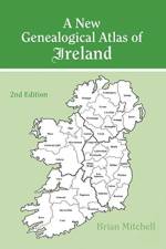
"Since its publication in 1986, A New Genealogical Atlas of Ireland has established itself as a key resource in Irish genealogical research. Now, with the addition of maps detailing the location of Roman Catholic parishes in all thirty-two counties of Ireland and Presbyterian congregations in the nine counties of Northern Ireland, this new 2nd Edition moves the book to the forefront of Irish genealogical research. Also, for the first time ever, this one volume contains a complete geographical picture of the three major religious denominations in Ireland during the middle years of the 19th century.And just what is the importance of this? Civil registration for everyone in Ireland didn't begin until 1864. Prior to that, the only records of births, marriages, and deaths were found in local parishes. Therefore, the first step in any Irish research for the first half of the 19th century and before should be to identify the religious denomination and parish of your ancestor. Although any of the Townland Indexes from 1851, 1871, or 1901 will show the location of each civil parish (which generally corresponds to the boundaries of the Church of Ireland parishes), it has been much more difficult to uncover the corresponding Catholic parish or Presbyterian congregation. Until now!This new 2nd Edition is not only invaluable for tracing your pre-1864 ancestors in church records but also for locating your post-1864 ancestor in civil records, for this volume provides descriptions and maps of the parochial and civil administrative divisions to which all major Irish record sources are linked. To aid the researcher in identifying the precise location of the administrative divisions, and thus their jurisdiction, Mr. Mitchell has drawn at least four, and sometimes five, maps for every county. The first county map depicts the civil/Church of Ireland parishes; the second shows the baronies and Church of Ireland dioceses; the third map illustrates the poor law unions and the parishes included within the probate districts serving that county; the fourth plots Roman Catholic parishes and dioceses; and the fifth locates Presbyterian congregations for the nine counties of Northern Ireland. Three maps of Ireland are also included to show the area covered by each county, diocese, and probate district. In addition, the book describes all of the major record sources of Ireland.These maps provide the clues to the Irish origins of millions of Americans, making this atlas indispensable for tracing ancestors in Ireland!"


