- A Map Of Britain During The Saxon Octarchy, Accompanied By A Table Showing The Contemporary Sovereigns Of Each State (1833)
von George William Collen
36,00 €
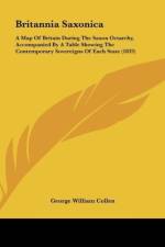
Britannia Saxonica is a historical atlas that was first published in 1833. The book features a detailed map of Britain during the Saxon Octarchy, which was a period of English history that lasted from the 5th to the 9th century. The map is accompanied by a table that lists the contemporary sovereigns of each state during this time period.The author of the book, George William Collen, was a British cartographer and engraver who specialized in historical maps. His work on Britannia Saxonica is considered to be one of the most comprehensive and accurate depictions of Britain during the Saxon Octarchy.The map itself is highly detailed and features a wealth of information about the various kingdoms and territories that existed during this time period. It includes the names of major cities, rivers, and other important landmarks, as well as the boundaries of each kingdom and the territories they controlled.The accompanying table provides additional information about each kingdom and its ruler, including their name, title, and the dates of their reign. This information is presented in a clear and concise format that makes it easy to understand and reference.Overall, Britannia Saxonica is a valuable resource for anyone interested in the history of Britain during the Saxon Octarchy. Its detailed map and comprehensive table provide a wealth of information about this fascinating period of English history.This scarce antiquarian book is a facsimile reprint of the old original and may contain some imperfections such as library marks and notations. Because we believe this work is culturally important, we have made it available as part of our commitment for protecting, preserving, and promoting the world's literature in affordable, high quality, modern editions, that are true to their original work.