Große Auswahl an günstigen Büchern
Schnelle Lieferung per Post und DHL

Atlas & Karten

Hier finden Sie eine Auswahl von über Atlas & Karten spannenden Büchern zum Thema 2.643.
Mehr anzeigen
Filter
Filter
Ordnen nachSortieren Beliebt
  •  
    14,95 €

    Der Falk Straßenatlas Deutschland wird ergänzt durch die beiden angrenzenden Reiseländer Österreich und Schweiz. In dem Detailmaßstab 1:300 000 sind selbst kleine Orte zu finden. Die praktische Spiralbindung sorgt zusätzlich für bestes Handling.

  • 21% sparen
    - From beans to brewing - coffees explored, explained and enjoyed
    von James Hoffmann
    26,00 €

    This ultimate guide to coffee contains comprehensive details on the beans and brews of more than 35 countries.

  • 23% sparen
    von Karen Macneil
    31,00 €

  •  
    17,00 €

    Embark on a grand tour of Europe with the 'Europe - Tourist and Motoring Atlas (A4-Spiral)'! Published by Michelin Editions on January 19, 2023, this atlas is a must-have for any avid traveler or motor enthusiast. This comprehensive guide provides detailed maps and touring information, making it easy to plan your next European adventure. The A4 spiral binding allows for easy use and durability, making it the perfect travel companion. Whether you're planning a road trip through the scenic countryside or exploring bustling city streets, this atlas has got you covered. Don't miss out on this essential guide, brought to you by the renowned publisher, Michelin Editions. Navigate Europe like never before!

  • 18% sparen
    - A Field Guide to the Hidden World of Everyday Design
    von 99% Invisible, Kurt Kohlstedt & Roman Mars
    21,00 €

    An alternative guide to the hidden everyday objects in a city, from the hugely successful podcast 99% Invisible

  • von Lonely Planet
    24,00 €

    Looking for an eco-friendly and convenient way to explore Europe? This ultimate guide to train travel reveals how to make the most of the continent's high-speed services, sleeper trains and scenic routes. Packed with maps and insider tips, you'll discover everything from how to piece together your trip to ways to book the best value tickets.

  • 33% sparen
    - 14th Edition
    von Times Atlases
    148,00 €

    The latest edition of the world's most prestigious and authoritative world atlas, containing up-to-date world maps and thematic information curated by experts in geography and cartography.

  • von Lonely Planet
    21,00 €

  • 18% sparen
    - Fifty Islands I Have Not Visited and Never Will
    von Judith Schalansky
    23,00 €

    An atlas that takes us across the oceans of the world to fifty remote islands. It features rare animals and lost explorers, marooned slaves and lonely scientists, mutinous sailors and forgotten castaways.

  • 21% sparen
  • - The 350 Most Beautiful Cycling Routes in Europe
    von Claude Droussent
    38,00 €

    Featuring lovely scenery and dramatic panoramas, these carefully selected tours of the most beautiful places to pedal throughout Europe are for both seasoned and novice cyclists and feature the groundbreaking user-sourced mapping technology of the Strava app.

  • von Berndt & Freytag
    19,90 €

    2 falsede kort over Mallorca i meget detaljeret målestok 1:50.000 indsat i plastomslag. Kortene har cykelruter indtegnet. Det ene kort dækker den nordlige del af øen, det andet den sydlige del.I plastomslaget ligger også et hæfte på 86 sider med beskrivelse af cykelruterne samt link til flere oplysninger, top-10 tips til seværdigheder samt register over byer og tilhørende postnumre samt bykort.

  • von Berndt & Freytag
    39,90 €

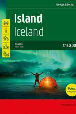
    Der Reiseatlas Island 1:150.000 ist der ideale Wegbegleiter für alle, die Island mit dem Auto oder öffentlichen Verkehrsmitteln erkunden möchte. Der Straßenatlas kann nicht nur für die Planung herangezogen werden, sondern erweist sich auch während der Reise als unverzichtbare Orientierungshilfe.Mit dem detailreichen Kartenbild und dem genauen Maßstab lässt sich das gesamte Straßennetz auf der Insel, inklusive der Hochlandstraßen, nachverfolgen. Die Ringstraße (Hringvegur) ist mit einer eigenen Straßensignatur hervorgehoben und sowohl der Golden Circle (Gullni hringurinn) als auch der Arctic Coast Way (Norðurstrandarleið) sind als touristische Straßen gekennzeichnet.Autofahrer können besonders nützliche Informationen aus dem Autoatlas herauslesen, wie etwa Straßenbelag, Furten (Flussüberquerungen), Rastplätze, Tankstellen und Autowerkstätten. Wohnwagenfahrer und Camper finden ein nützliches Verzeichnis von Campingplätzen und Stellplätzen. Für alle Reisenden, die lieber mit dem Bus unterwegs sind, steht eine Übersichtskarte mit den öffentlichen Verkehrsmitteln zur Verfügung.Informationen zum Reiseatlas IslandIsland 1:150.00018 Stadt- und Ortspläne232 Seiten, Format 21 x 29,7cm (A4)Halbverdeckte SpiralbindungCamping- und Stellplätze, Unterkünfte30 Highlights beschriebenOrts- und GewässerverzeichnisDamit sich Islandbesucher auf der Insel zurechtfinden, wurden in den Karten touristisch relevante Informationen, darunter Nationalparks und Naturschutzgebiete, schöne Ausblicke, Wasserfälle, heiße Quellen und beliebte Orte für die Walbeobachtung, visualisiert.Der Inselstaat Island (Ísland) ist wie kein anderes europäisches Land von schlummernden Vulkanen, kahlen Lavafeldern, mächtigen Gletschern, speienden Geysiren, tosenden Wasserfällen, naturbelassenen Flüssen sowie heißen und kalten Quellen geprägt. Es ist das Land der Extreme, wo das Wasser gemächlich aus dem Boden blubbert, Fontänen wild aus dem Untergrund herausschießen und die Erde in regelmäßigen Abständen bebt, aber wo sich auch fruchtbare Flusstäler und sanfte Küstenbereiche erstrecken.Gedruckt in Österreich.

  • 17% sparen
    von Dave Broom
    42,00 €

    'The best whisky book ever - a must-read for drinkers!' - Forbes'The perfect go-to reference guide for the whisky lover's bookshelf' - Whisky MagazineAward-winning author and whisky expert Dave Broom profiles more than 400 distilleries and tastes more than 800 whiskies. There has been major growth in the world of whisky in the last decade, with many more distilleries opening, and this new edition brings the world of whisky right up to date.The World Atlas of Whisky is the only guide the connoisseur and newcomer will ever need in order to understand everything there is to know about the world of whisky. This is a beautifully illustrated, in-depth and comprehensive journey through the history, process, distilleries and expressions of world whiskies, featuring detailed full-colour maps. Heritage, romance, flavour and craftsmanship are all celebrated in this complete study of this most versatile of drinks.

  • von Michelin
    9,95 €

    Hæftet miniatlas over den kendte pilgrims vandrerute i målestokken 1:150.000. Kortet dækker fra St-Jean-Pied-de-Port til Santiago de Compostela. Indeholder oversigt over herberger og refugier samt praktisk information.

  • - The Monocle Travel Guide Series
    von Monocle
    18,00 €

    Think of Athens and the first things that spring to mind are ancient ruins and camera-toting crowds (before they hotfoot it to the island-bound ferries at the port of Piraeus, that is). It's true, the Acropolis is ever present and during summer the city thrums with schools of holidaymakers. But there's much more to the Greek capital than temples and tourists.We've looked beyond the admittedly awe-inspiring Parthenon and explored the city's modernist marvels, from circular school to colonnaded embassy. We've combed the cobbled streets for independent boutiques offering straw hats, hand-thrown ceramics and golden jewellery - all proudly "Made in Greece". When you're feeling peckish, choose between traditional family-run tavernas and contemporary restaurants spicing up classic Greek dishes.Attica is a region of riches and, of course, some of the nearby islands are simply too good to miss - so we've included a short and sharp list of our top stopovers. For now, though, strap up your sandals and allow us to introduce you to this chaotic but ever-so-charismatic city.

  • von Anthony Ham
    20,00 €

  • 11% sparen
    von DK Eyewitness
    17,00 €

    Take your time with Road Trips France our redesigned and newly updated guide containing 24 leisurely drives through the country's beautiful towns and stunning landscapes.Driving through France is the perfect way to appreciate its amazing diversity - craggy mountains and wild coastlines, tranquil valleys and ancient hilltop villages. Includes practical information, detailed maps and inspiring ideas, the driving tours in Road Trips France will lead you to the unhurried pleasures of rural France.Inside Road Trips France:- 24 easy-to-follow scenic driving tours, each lasting one to five days- Information on the French rules of the road - Postcodes for use with GPS, plus useful advice on road conditions, speed limits and parking- Hotels, restaurants, shops and vineyards where you can savour superb local food and wine- Best experiences along each route: get active on walks, boat trips, bike rides and hikes; or discover fine art and architecture through the ages- A fresh new design: Road Trips is an exciting new take on the DK Eyewitness Back Roads series, redesigned and fully updated.Looking for a comprehensive e-guide to the whole of France? Try our DK Eyewitness France.About DK Eyewitness: Our Road Trips take the work out of planning a driving tour, with easy-to-read maps, tips and tours to inform and enrich your journey. DK is the world's leading illustrated reference publisher, producing beautifully designed books for adults and children in over 120 countries.

  • - Band 13: Baden-Wurttemberg / Bayern
    von Stefan Bogner
    19,90 €

    Photographer Stefan Bogner went in search of the top roads in Southern Germany: Fantastic views, endless curvy roads and gastronomic highlights make a very special guidebook! Text in English and German.

  • 12% sparen
    von DK Eyewitness
    18,00 €

  • 13% sparen
    - Discover Intriguing Boundaries, Territories and Geographical Curiosities
    von Zoran Nikolic
    17,00 €

    A beautifully presented gift for anyone with an intrigue for geographical curiosities. This beautifully designed book presents unusual borders, enclaves and exclaves, divided or non-existent cities and islands.

  • - FB.530
     
    12,90 €

  • 13% sparen
    von Michael Howe
    17,00 €

    The joys of the world, one terrible map at a time ¿ this is the ultimate gift book for the budding geographer or anyone who wants to have a laugh.

  • von Esterbauer Verlag
    17,90 €

    The Danube bicycle route between Passau and Vienna ranks as Europe's best-known and most-loved cycling route - and for good reason. No other section of the river offers as diverse a range of landscapes and cultural landmarks or as many historical sites. Tranquil valleys, fertile plains, and steep vineyards line the banks of one of Europe's great rivers, where pretty farms and glorious abbeys stand side-by-side. The loop of the Danube at Schlögen, the abbey at Melk, and the romantic Wachau wine-producing region are just some of the highlights along the 330 kilometer route.

  • 15% sparen
    von Liza Karsemeijer
    14,00 €

    This isn't your ordinary travel guide. Beyond Rome's iconic ancient ruins are hidden street food haunts, buzzing aperitivo spots and scenic walks that locals love - and that's where this book takes you.--

  •  
    19,00 €

  • von Berndt & Freytag
    29,90 €

    Der Autoatlas Kroatien - Slowenien 1:150.000 ist der ideale Begleiter für alle, die mit dem Auto unterwegs sind und dabei nicht nur die Hauptstraßen und Autobahnen nutzen möchten. Er ist ideal für die Planung und erweist sich auch während der Reise als unverzichtbare Orientierungshilfe.Mit dem detaillierten Kartenbild und dem genauen Maßstab lassen sich auch weniger befahrene Nebenstraßen entdecken, die in Übersichtskarten meist gar nicht eingezeichnet sind. Landschaftlich schöne Strecken sind farblich hervorgehoben.Informationen zum Straßenatlas Kroatien - SlowenienKroatien - Slowenien 1:150.000Europa 1:3.500.000Spiralbindung verdecktCamping- und StellplätzeTouristische InformationenOrtsregister mit Postleitzahlen19 Innenstadtpläne224 Seiten, Format 23 x 29,7 cmDer ideale Autoatlas für Kroatien und Slowenien Das dichte Straßennetz ist exakt abgebildet, landschaftlich schöne Abschnitte und Touristenstraßen sind farblich hervorgehoben und viele Ausflugsziele sind in der Karte eingezeichnet.Auto- und Motorradfahrer schätzen die exakte Kartographie von freytag & berndt besonders für die Planung und Orientierung vor Ort. Damit die Reise auch mit Wohnmobil, Wohnwagen oder Camper gut planbar ist, sind alle Camping- und Stellplätze im Atlas eingezeichnet. Verdeckte Spiralbindung Der Autoatlas Kroatien - Slowenien ist besonders komfortabel in der Handhabung da er sich durch die Spiralbindung bequem aufklappen lässt. So bleibt die gewünschte Seite auch während der Fahrt immer geöffnet. Innenstadtpläne Mit den enthaltenen Cityplänen kann man sich in den Städten gut orientieren, darunter etwa Dubrovnik, Pula, Rijeka, Split, Zagreb, Ljubljana und Maribor;.Gedruckt in Österreich

  • 12% sparen
    - A Journey to the World's Most Unusual Corners
    von Travis Elborough
    11,48 €

    Atlas of Improbable Places shows the modern world from surprising new vantage points that will inspire urban explorers and armchair travellers alike to consider a new way of understanding the world we live in.

Willkommen bei den Tales Buchfreunden und -freundinnen

Jetzt zum Newsletter anmelden und tolle Angebote und Anregungen für Ihre nächste Lektüre erhalten.