Große Auswahl an günstigen Büchern
Schnelle Lieferung per Post und DHL

Atlas & Karten

Hier finden Sie eine Auswahl von über Atlas & Karten spannenden Büchern zum Thema 3.061.
Mehr anzeigen
Filter
Filter
Ordnen nachSortieren Beliebt
  • von Collins Maps
    16,00 €

    Fully revised and updated reference atlas in the exciting Collins world atlas range. This atlas provides more mapping area than any other atlas at this price.

  • - The World According to Illustrators and Storytellers
     
    39,90 €

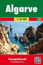
  • von Freytag & Berndt
    12,90 €

    Falset kort i målestokken 1:150.000. Turistkort med mange praktiske informationer. Seværdigheder, campingpladser, vejbeskaffenhed og omfangsrigt stednavneregister med postnumre. Indsat bykort over Pristina. Afstandstabel og beskrivelse af de bedste seværdigheder. Indsatte bykort over: Lagos, Portimao, Praia da Rocha, Albufeira, Vilamoura, Faro ogTavira.

  • von Eric Newman
    44,00 €

  • - Giant Format, 600+ Pages: The #1 Global Reference, Complete & Unabridged - Vol. 1 of 3, Introduction, Maps, World, Afghanistan Gabon
    von Central Intelligence Agency
    34,00 €

    THE COMPREHENSIVE, RELIABLE, INDISPENSABLE GLOBAL REFERENCE WORK - FULLY UPDATED FOR 2020VOLUME 1 OF 3 - CONTAINS:Introduction: History of the Factbook, Guide to Country Profiles, Definitions and Notes, 39 Pages of Regional and World Reference Maps.Countries: World, Afghanistan to Gabon.For Volume 2, search for "1949117146".For Volume 3, search for "1949117154".Unique three-volume, large-format edition.Giant 8"x10" size - easy to read and navigate.New for 2020: expanded maps section - two-page world maps now each occupy three pages for greater detail.Complete & unabridged - 1,800+ pages total, 600+ pages per volume."Batteries last hours, books last decades. Get the print edition!"Looks AMAZING on any professional or home bookshelf!The World Factbook provides up-to-date information on the history, people, government, economy, geography, communications, transportation, military, and transnational issues for 267 world entities. This almanac-style reference work is created with input and data from numerous government departments, and is the single most accurate source of intelligence on the nations and peoples of our world.CREATED BY THE CIA, TRUSTED BY INTELLIGENCE OFFICERS, DIPLOMATS, ACADEMICS, JOURNALISTS AND OTHER PROFESSIONALS AROUND THE GLOBE.Sources include: Antarctic Information Program (National Science Foundation) - Armed Forces Medical Intelligence Center (Department of Defense) - Bureau of the Census (Department of Commerce) - Bureau of Labor Statistics (Department of Labor) - Council of Managers of National Antarctic Programs - Defense Intelligence Agency (Department of Defense) - Department of Energy - Department of State - Fish and Wildlife Service (Department of the Interior) - Maritime Administration (Department of Transportation) - National Geospatial-Intelligence Agency (Department of Defense) - Naval Facilities Engineering Command (Department of Defense) - Office of Insular Affairs (Department of the Interior) - Office of Naval Intelligence (Department of Defense) - Oil & Gas Journal - United States Board on Geographic Names (Department of the Interior) - United States Transportation Command (Department of Defense) - and more...Proudly Published in the U.S.A. by CARLILE MEDIA.

  • von Freytag & Berndt
    12,90 €

    Falset kort i målestokken 1:1 mio. med afstandstabeller samt turistinformationer.

  • von Freytag & Berndt
    12,90 €

    Falset landkort i målestokken 1:500.000. Kortet er indsat i et omslag sammen med et lille hæfte med 5 bykort og et stednavneregister med postnumre.

  • - Discover Intriguing Boundaries, Territories and Geographical Curiosities
    von Zoran Nikolic
    15,00 €

    A beautifully presented gift for anyone with an intrigue for geographical curiosities. This beautifully designed book presents unusual borders, enclaves and exclaves, divided or non-existent cities and islands.

  • von Jacob F. Field
    18,00 €

    All 195 countries illustrated and explained in an instant

  • - London's Underground History of Tube Station Names
    von David Hilliam
    14,98 €

    The names of the 300 or so underground stations are part of everyday life for Londoners, but we hardly ever question their history. This entertaining book delves into their origins, ensuring you never view your journey in the same way again.

  • - REISE.1240
     
    9,95 €

  •  
    11,95 €

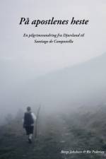
  • - En pilgrimsvandring fra Djursland til Santiago de Compostela
    von Rie Pedersen & Børge Jakobsen
    22,00 €

    " - Tænk at være faret vild, ikke at kunne genkende noget som helst, mindre end ti kilometer fra mit hjem! Hvordan skal jeg overhovedet få vandret de resterende 3500 kilometer, der ligger foran mig?" Så drastisk begynder vandringen for Børge Jakobsen, én af de tusind danskere der hvert år drager på pilgrimstur. Men han har valgt at tage apostlenes heste hele vejen fra Djursland til Santiago de Compostella i Spanien. Som mange andre har han en drøm om frihed og fordybelse: at komme væk fra hverdagens stress, finde ind til de dybere lag i sig selv og få en inderligere kontakt med det spirituelle. Bogen skildrer udlevelsen af denne drøm: Pilgrimsturens op- og nedture, og hvad der sker med sindet under så lang en vandring.

  • von Mubarik Mahamud
    16,95 €

    Diploma Thesis from the year 2023 in the subject Tourism - Miscellaneous, , course: Final Year Project, language: English, abstract: The study identified millet as an important grain in the production of pancakes in Ghana, truncating excessive wheat importation and ensuring self-reliance. Accordingly, millet flour was produced, and a standardised recipe developed for its use in the preparation of pancake. These pancakes were encoded and submitted for a sensory evaluation of 22 tasters. They gave their valuation on the colour, taste, texture, flavour, appearance and overall quality of each product following a hedonic scale of 9 points: 9 (I like extremely) to 1 (I don¿t like). The finding of the research indicates that the objectives of the had been achieved. However, having gone through the various procedures of testing the pancakes prepared from millet flour, the following were observed. The determinants (color, taste, flavor, texture and appearance) are a good technique that could be used to add value to it. The determinants as well as the packaging material used does not only attract consumers but also improved the quality, standard and hygiene of the product. Finally, it must be emphasized that, if all the necessary recommendations suggested from the findings of this research, it would advance the government of Ghanäs call for reduce importation of wheat, while ensuring food security.

  • von Esterbauer Verlag
    16,90 €

  • von Esterbauer Verlag
    16,90 €

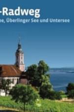
    Auf dem ersten Teil des Ostseeküsten-Radweges radeln Sie einmal quer durch Schleswig- Holstein vom schmucken Städtchen Flensburg zum Ostseebad Travemünde und schließlich in die historische Stadt Lübeck, nehmen unterwegs noch die Fördestadt Kiel und die gesamte Insel Fehmarn mit. Auf dieser Radreise entlang der Ostseeküste können Sie eine abwechslungsreiche Landschaft genießen. Während Sie Ihren Blick auf der einen Seite über den Strand unddie Weite des Meeres schweifen lassen oder sich in dessen Fluten erfrischen und vergnügen, präsentiert sich das Binnenland mit einer Vielzahl von Landschaftsvariationen und kulturellen Angeboten. Sollten Sie am Ende davon nicht genug bekommen - die Ostseeküste ist in Travemünde ja noch lange nicht zu Ende ...

  • von Gaby Gölz
    24,95 €

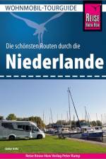
    Dieser Wohnmobil-Tourguide Niederlande ist der ideale Begleiter, um die schönsten Regionen der Niederlande zu erkunden. Zwölf detaillierte Routenbeschreibungen - über 340 Camping- und Stellplatzbeschreibungen, Park- und Picknickplätze inkl. GPS-Daten und Anfahrt - 14 Seiten Routenatlas - landschaftliche Höhepunkte mit einzigartigen Naturparks, sehenswerte Städte, charmante Dörfer, kilometerlange Strände, herrliche Fahrrad- und Wandertouren - wertvolle Tipps für Restaurantbesuche und den Kauf lokaler Produkte. Dazu: kostenlose Web-App für Smartphone, Tablet und PC mit Lage der Camping- und Stellplätze inkl. Satellitenansichten, Routenführung dorthin und seitenbezogenen News und Korrekturen nach Redaktionsschluss, direkt aufrufbar über den QR-Code auf der Buchrückenseite. GPS-Daten zum Download. Für Wohnmobilisten sind die Niederlande mit ihrer ausgezeichneten Infrastruktur ein ideales Reiseziel. Dieser Band wendet sich sowohl an Neueinsteiger als auch an "alte Hasen". Neben einer Auswahl der schönsten Stell- und Campingplätze erhält der Leser eine Fülle von Anregungen für Besichtigungen, Fahrradtouren, Wanderungen, Wassersport und vieles mehr. Zwölf miteinander verbundene Routen führen zu den touristischen Highlights und ebenso zu Zielen abseits ausgetretener Pfade. Neben malerischen Städten und reizvollen Dörfern kommt die eindrucksvolle Landschaft der Niederlande nicht zu kurz. Die erfahrene Reisejournalistin und engagierte Fotografin Gaby Gölz führt den Leser durch unser faszinierendes, sympathisches Nachbarland. Aus dem Inhalt: Zwölf detailliert ausgearbeitete und kombinierbare Routenvorschläge Park-, Camping- und Stellplätze mit allen Details Stadtbesichtigungen mit geeigneten Stell- und Parkplätzen Sehenswürdigkeiten, Restaurants und Einkaufsmöglichkeiten 15 übersichtliche Stadtpläne, abgestimmt mit dem Text Die schönsten Strände an Nordsee, Grevelingen-, Marken- und IJsselmeer sowie an den Binnenseen 14 Seiten Routenatlas mit Stell- und Campingplätzen Durchgängig GPS-Daten Ver- und Entsorgungsstellen entlang der Routen Ratschläge zur Sicherheit und Pannenhilfe Kurzweilige Exkurse zu historischen und kulturellen Themen Deutsch-Niederländisch-Wörterliste mit speziellem Womo-Vokabular   Wohnmobil-Tourguide - die aktuellen Bordbücher von Reise Know-How zu den beliebtesten Wohnmobil-Regionen Europas. Fundiert, übersichtlich, praktisch. Mit exakten Routenkarten und Stadtplänen, stimmungsvollen Fotos, strapazierfähiger Bindung, GPS-Stellplatzdaten zum Herunterladen ...

  • - Authors, Titles And Subjects, 1900 (1900)
    von Jessie Palmer Weber
    30,00 €

    The ""Alphabetic Catalog Of The Books, Manuscripts, Maps, Pictures, And Curios Of The Illinois State Historical Library: Authors, Titles And Subjects, 1900"" is a reference book compiled by Mrs. Jessie Palmer Weber. It was published in 1900 and serves as a comprehensive catalog of the materials held in the Illinois State Historical Library. The catalog is organized alphabetically by author, title, and subject, making it easy for researchers and historians to locate specific items of interest. The materials contained within the catalog include books, manuscripts, maps, pictures, and curios, providing a rich and diverse collection of historical resources. This book is an invaluable tool for anyone interested in the history of Illinois and the Midwest region of the United States.This scarce antiquarian book is a facsimile reprint of the old original and may contain some imperfections such as library marks and notations. Because we believe this work is culturally important, we have made it available as part of our commitment for protecting, preserving, and promoting the world's literature in affordable, high quality, modern editions, that are true to their original work.

  • von Anonymous
    19,95 €

    Seminar paper from the year 2023 in the subject Tourism, grade: 1,3, University of Applied Sciences Wernigerode (International Tourism Studies), language: English, abstract: The primary objective of this study is to investigate the impact of tourism on Joshua Tree National Park. The study addresses questions such as the recent developments in tourism, its economic impact on the region, the most affected economic sectors, and how these impacts influence the local population. The work concludes with recommendations for politics, management, and the local population.Joshua Tree National Park holds historical, cultural, and ecological significance. Despite global challenges like the COVID-19 pandemic, it remained the second most visited national park in California, underlining its importance. Situated east of Palm Springs, it is a unique blend of the Mojave and Colorado Deserts, offering over 32 hiking trails and diverse flora covering approximately 85% of roadless wilderness.The park's popularity surged post-World War II during the economic boom, transforming it into a prominent recreational destination. It was declared a national monument in the 1950s, attracting notable figures and becoming a hub for spiritual and cultural rejuvenation. The trend continued, leading to its designation as a national park in 1994.

  • von Esterbauer Verlag
    16,90 €

  • von Nikolaus Philippi
    19,95 €

    Autor: Nikolaus Philippi - Taschenbuch A 4 mit 56 Seiten und 45 AbbildungenÜBER DAS BUCH:Großherzogtum Baden. Was war das für ein Territorium und was ist das heute? Wie kam es zum heutigen Baden-Württemberg? Fragen, die in diesem Buch beantwortet und geklärt wurden. Interessant, was die eingearbeiteten Zeichen auf den Grenzsteinen zu bedeuten haben. Wegen aller Besonderheiten in Sachen Grenze, die Wiechs am Randen im Großherzogtum Baden gegen dem schweizerischen Nachbarn Schaffhausen erlebt hat, ist es gerade dieser Ort wert, näher betrachtet zu werden.INHALT:Einleitung 4Ortschaft Wiechs am Randen 5Etwas regionale Geschichte 5Territorialzeit 6Entstehung des Großherzogtums Baden 6Deutsches Kaiserreich 7Ende des Kaiserreichs - Übergang zur Republik 7Bundesrepublik Deutschland 8Grenzbildung und -markierung 10Die Gemarkung Wiechs am Randen in historischen Karten 11Grenzvertrag 1839 13Bedeutung des Vertrags 18"Nachlese" zum Grenzvertrag 20Grenzbereinigung im "Schlauch" mit Kanton Schaffhausen 21Schweizer und deutsche "Stimmen" zum letzten Grenzvertrag 25Kurioser Grenzstein bei Wiechs am Randen 28Impressionen um und aus Wiechs am Randen 29"Stumme Wächter" um Wiechs am Randen 33Der Zoll im "Schlauch" 54Abschließende Grenzwanderung 54

  • von Dean Jacobs
    29,00 €

    Welcome to Dubai in 2024, a glamorous city where innovation and tradition coexist and modern skylines blend with historic charms! Situated in the centre of the United Arab Emirates, Dubai entices visitors with a striking blend of contemporary wonders, cultural treasures, and thrilling adventures, guaranteeing a voyage that will never be forgotten. Imagine a city where every corner tells a story of history and development, and where every skyline silhouette is an architectural wonder as you set out on this virtual tour. We cordially welcome you to explore a rainbow of experiences in our travel guide, which provides an overview of Dubai's enthralling charm in 2024.Dubai is known for pushing the envelope when it comes to magnificence and innovation. Experience the bold architectural achievements of the city that redefine possibilities, from the world's tallest structure, the Burj Khalifa, which pierces the skies, to the breathtaking archipelago of the Palm Jumeirah. Nestled among the glistening skyscrapers are the poignant relics of Dubai's past and customs. Explore the cultural legacy of the city by visiting museums tucked away in old neighbourhoods like Al Fahidi. Dubai's history melds with its forward-thinking goals to create an old world charm woven into a contemporary design.Dubai offers plenty of options for both thrill-seekers and leisure travellers. Imagine going skydiving and scaling the Palm Jumeirah or dune bashing over the vast Arabian Desert. Dubai has a wide range of outdoor activities to suit every taste, from heart-pounding pursuits to tranquil beachside leisure.Shopping in Dubai is a unique experience. Discover the biggest malls in the world, such as The Dubai Mall, a maze of upscale shops and extravagant entertainment venues. Explore classic souks like the Gold Souk, where the perfume of spices and the shimmer of precious metals create a mesmerising atmosphere. Your ticket to discovering Dubai's alluring soul in 2024 is this guide. Come explore the city's many offers with us as we reveal its colourful mosaic of creativity, adventure, and culture. Get ready to be enthralled by a city that expertly combines its historical legacy with its forward-thinking goals, ensuring that each visitor has an experience that is unmatched. Dubai is here to fascinate and mesmerise your senses!

  • von Peter Alfred Crossby
    39,00 €

    This scarce antiquarian book is a facsimile reprint of the original. Due to its age, it may contain imperfections such as marks, notations, marginalia and flawed pages. Because we believe this work is culturally important, we have made it available as part of our commitment for protecting, preserving, and promoting the world's literature in affordable, high quality, modern editions that are true to the original work.

  • von Robert Allen Campbell
    19,00 €

    This scarce antiquarian book is a facsimile reprint of the original. Due to its age, it may contain imperfections such as marks, notations, marginalia and flawed pages. Because we believe this work is culturally important, we have made it available as part of our commitment for protecting, preserving, and promoting the world's literature in affordable, high quality, modern editions that are true to the original work.

  • von Hon. Horst Schauerte
    29,99 €

    Nach einem kurzen Vorwort wird eine Replik eines Taschenfahrplans von 1902 für die Bodenseeregion dargestellt. Alle Seite sind vom bestens erhaltenen Originalexemplar abgenommen. Es werden Schiffs-, Bahn-, Personenpost- und Seilbahnverbindungen dargestellt.

  • - Quatorzieme Annee, 1889 (1889)
    von Albert Kaempfen
    26,00 €

    This scarce antiquarian book is a facsimile reprint of the original. Due to its age, it may contain imperfections such as marks, notations, marginalia and flawed pages. Because we believe this work is culturally important, we have made it available as part of our commitment for protecting, preserving, and promoting the world's literature in affordable, high quality, modern editions that are true to the original work.

  • von Michelin
    11,95 €

    Updated annually, MICHELIN National Map France Route Planning (map 726) will give you an overall picture of your journey thanks to its clear and accurate mapping scale 1/1 000 000. Our map will help you easily plan your safe and enjoyable journey in France thanks to a comprehensive key, a complete name index as well a clever time & distance chart. Michelin's driving information will help you navigate safely in all circumstances. In addition, MICHELIN National Map France Route Planning includes information on service stations and areas so that you can have enjoyable break during your journey! With MICHELIN National Maps, find more than just your way!MICHELIN NATIONAL MAPS feature:- Up-to-date mapping - A scale adapted to the size of the country - A clear and comprehensive key - Distance and time chart - Place name index - Driving and road safety information

  • von Michelin
    9,95 €

    MICHELIN zoom map Zoom Barcelona & Costa Brava is the ideal travel companion to fully explore this tourist destination thanks to its easy-to-use format and its scale of 1/150,000. In addition to Michelin's clear and accurate mapping, MICHELIN Zoom map highlights all the leisure activities available, such as golf clubs and tourist trains. MICHELIN Zoom Maps also include star-rated scenic routes, tourist sights & attractions, as well as camping sites and hotels selected in the famous MICHELIN guides. Make the most of your stay with MICHELIN Zoom Maps!MICHELIN ZOOM MAPS are perfect to discover major tourist areas, with a high level of details in an easy to use format. They nicely complement our Michelin Guides and include: - Various leisure activities, such as water parks, tourist trains, horse racing, etc- Scenic routes and tourist sights crossed referenced with the famous Michelin's Green Guides- Camping sites information from Michelin's Camping Guides- Hotel information from the world famous MICHELIN Guides

  • von Michelin
    11,95 €

    MICHELIN National Map Southeastern France will give you an overall picture of your journey thanks to its clear and accurate mapping scale 1:500.000. Our map will help you easily plan your safe and enjoyable journey in Southeastern France thanks to a comprehensive key, a complete name index as well a clever time & distance chart. Michelin's driving information will help you navigate safely in all circumstances. In addition, MICHELIN National Map Southeastern France is cross-referenced with the famous MICHELIN Green Guide highlighting destinations worth stopping for! With MICHELIN National Maps, find more than just your way!- Up-to-date mapping - A scale adapted to the size of the country - A clear and comprehensive key - Distance and time chart - Place name index - Driving and road safety information - Tourist sights information

Willkommen bei den Tales Buchfreunden und -freundinnen

Jetzt zum Newsletter anmelden und tolle Angebote und Anregungen für Ihre nächste Lektüre erhalten.