Große Auswahl an günstigen Büchern
Schnelle Lieferung per Post und DHL

Bücher veröffentlicht von MICHELIN

Filter
Filter
Ordnen nachSortieren Beliebt
  • von Michelin
    9,95 €

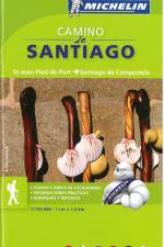
    Hæftet miniatlas over den kendte pilgrims vandrerute i målestokken 1:150.000. Kortet dækker fra St-Jean-Pied-de-Port til Santiago de Compostela. Indeholder oversigt over herberger og refugier samt praktisk information.

  • von Michelin
    11,95 €

    Updated annually, MICHELIN National Map France Route Planning (map 726) will give you an overall picture of your journey thanks to its clear and accurate mapping scale 1/1 000 000. Our map will help you easily plan your safe and enjoyable journey in France thanks to a comprehensive key, a complete name index as well a clever time & distance chart. Michelin's driving information will help you navigate safely in all circumstances. In addition, MICHELIN National Map France Route Planning includes information on service stations and areas so that you can have enjoyable break during your journey! With MICHELIN National Maps, find more than just your way!MICHELIN NATIONAL MAPS feature:- Up-to-date mapping - A scale adapted to the size of the country - A clear and comprehensive key - Distance and time chart - Place name index - Driving and road safety information

  • von Michelin
    11,95 €

    MICHELIN National Map Southeastern France will give you an overall picture of your journey thanks to its clear and accurate mapping scale 1:500.000. Our map will help you easily plan your safe and enjoyable journey in Southeastern France thanks to a comprehensive key, a complete name index as well a clever time & distance chart. Michelin's driving information will help you navigate safely in all circumstances. In addition, MICHELIN National Map Southeastern France is cross-referenced with the famous MICHELIN Green Guide highlighting destinations worth stopping for! With MICHELIN National Maps, find more than just your way!- Up-to-date mapping - A scale adapted to the size of the country - A clear and comprehensive key - Distance and time chart - Place name index - Driving and road safety information - Tourist sights information

  • von Michelin
    11,95 €

    MICHELIN National Map Southwestern France will give you an overall picture of your journey thanks to its clear and accurate mapping scale 1:500.000. Our map will help you easily plan your safe and enjoyable journey in Southeastern France thanks to a comprehensive key, a complete name index as well a clever time & distance chart. Michelin's driving information will help you navigate safely in all circumstances. In addition, MICHELIN National Map Southeastern France is cross-referenced with the famous MICHELIN Green Guide highlighting destinations worth stopping for! With MICHELIN National Maps, find more than just your way!- Up-to-date mapping - A scale adapted to the size of the country - A clear and comprehensive key - Distance and time chart - Place name index - Driving and road safety information - Tourist sights information

  • von Michelin
    11,95 €

    MICHELIN National Map northeastern France will give you an overall picture of your journey thanks to its clear and accurate mapping scale 1:500.000. Our map will help you easily plan your safe and enjoyable journey in northeastern France thanks to a comprehensive key, a complete name index as well a clever time & distance chart. Michelin's driving information will help you navigate safely in all circumstances. In addition, MICHELIN National Map northeastern France is cross-referenced with the famous MICHELIN Green Guide highlighting destinations worth stopping for! With MICHELIN National Maps, find more than just your way!- A scale adapted to the size of the country - A clear and comprehensive key Distance and time chart - Place name index - Driving and road safety information - Tourist sights information

  • von Michelin
    9,95 €

    The MICHELIN Saone et Loire local map, scale 1/150,000 is the ideal companion to fully explore this northern part of France and provides star-rated Michelin tourist itineraries and attractions, as well as impressive 3D relief mapping. MICHELIN local maps are perfect for cyclist and outdoor enthusiasts with over 20 leisure symbols, extensive coverage of cycling paths and nature trails. With MICHELIN local maps, find more than just your way! - Impressive & realistic 3D relief mapping - Michelin selected itineraries and must-sees of the area - A clear and comprehensive key with 20 leisure symbols, as well as cycling paths and nature trails. - Star rated tourist sights and attractions cross referenced with the famous MICHELIN Green Guides. - Main cities plans and a comprehensive place name index

  • von Michelin
    9,95 €

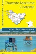
    The MICHELIN Charente, Charente Maritime local map, scale 1/150,000 is the ideal companion to fully explore this northern part of France and provides star-rated Michelin tourist itineraries and attractions, as well as impressive 3D relief mapping. MICHELIN local maps are perfect for cyclist and outdoor enthusiasts with over 20 leisure symbols, extensive coverage of cycling paths and nature trails. With MICHELIN local maps, find more than just your way! - Impressive & realistic 3D relief mapping - Michelin selected itineraries and must-sees of the area - A clear and comprehensive key with 20 leisure symbols, as well as cycling paths and nature trails. - Star rated tourist sights and attractions cross referenced with the famous MICHELIN Green Guides. - Main cities plans and a comprehensive place name index

  • von Michelin
    29,95 €

    The MICHELIN Guide Germany is carefully researched, with objective recommendations for luxurious accommodation, country inns, wine taverns to elegant restaurants. Anonymous inspectors use the famed Michelin star rating system to create an extensive selection of great places to eat and stay for all budgets. Recommendations to more than 1330 delicious restaurants. (minimal text is in the language of the country.) Craft a memorable journey with the recommendations and helpful maps in this annual update. From Starred to highly recommended reatuarants traditional or starred restaurants for a special occasion. Awards such as the Bib Gourmand indicitive of an affordable and enjoyable meal. Plates identifying restaurants offering a good meal. Covering traditional dishes and starred restaurant menus for every occasion... Descriptive symbols and an English legend tell you all you need to know. To make your visit memorable, the MICHELIN guide has an easy-to-use format, featuring:- Longer more in depth descriptions for two and three star restaurants - Thematic indexes to help you make the right choice - Cultural and practical information - Cuisines from around the world, in all price bands - City map locating the guide's hotels and restaurants - Lively description for each entry with pictures, including price indications

  • von Michelin
    11,95 €

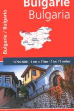
    Falset kort i målestokken 1:700.000 med register. På kortet er markeret seværdigheder, som er omtalt i Michelin Green Guide Romania. Indsatte bykort over Sofia, Plovdiv samt Varna.

  • von Michelin
    9,95 €

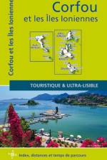
    MICHELIN Zoom Map Corfu will give you an overall picture of your journey thanks to its clear and accurate mapping scale 1/80,000. Our map will help you easily plan your safe and enjoyable journey thanks to a comprehensive key, a complete name index as well a clever time & distance chart. Michelin's driving information will help you navigate safely in all circumstances. With MICHELIN National Maps, find more than just your way! Corfu, the northernmost of the Ionian Islands in Greece. Located off of the far northwest coast of the Greece, Corfu is in the Ionian sea, east of Italy and southwest of Albania. MICHELIN NATIONAL MAPS feature: - Up-to-date mapping - A scale adapted to the size of the country - A clear and comprehensive key - Distance and time chart - Place name index - Driving and road safety information - Tourist sights information

  •  
    9,95 €

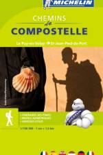
    Hæftet miniatlas på 96 sider, med den franske pilgrimsrute der går fra Le Puy-en-Velay til Saint-Jean-Pied-de-Port. Ud over kortmaterialet er der en oversigt over herberger og refugier samt praktisk information om sværhedsgrad, afstande og andre praktiske tips.

  •  
    9,95 €

    Falset kort i målestokken 1:200.000.

Willkommen bei den Tales Buchfreunden und -freundinnen

Jetzt zum Newsletter anmelden und tolle Angebote und Anregungen für Ihre nächste Lektüre erhalten.